It has been an interesting time chasing down Syrian WMD capability, to say the least! Starting from a short list, that expanded to cover chemical, biological and nuclear abilities, plus long range missile capabilities. From experts and intelligence experts to members of Congress to a dissident Syrian journalist who has first hand knowledge of the sites, I have been piecing this together bit by bit and coming to some very basic conclusions.
First, and most importantly, is that the phosphate deposits in Syria are a multi-part threat. Phosphates, of course, are used in agriculture for fertilizer and in the steel and glass-making businesses, along with standard chemical industry. Phosphate is one of the basic building blocks of life and a necessary element for life to continue. As such it also serves as the dual basis for the chemical and biological weapons development going on in Syria. The prime mover in this is that Syria has not signed on to the Chemical Weapon's Convention and feels free to develop such weapons. On the biological weapons side, things are a bit more nebulous: even though a treaty signatory, Syria has been putting together a multi-use pharmaceutical industry which would also serve as the basis for a bioweapons industry.
A number of pharmaceutical sites that had been constructed, however, have been abandoned, some while only partially complete. While Syria is a relatively poor Nation, starting large industrial capability and then not following through on same either points to extremely poor internal planning or to deliberate deception. Syria does aim to become a net exporter of finished pharmaceuticals, and that has been their state goal for some years. That said the entire suite of capability necessary for that in the way of equipment is 'dual use' with the bioweapons manufacturing area. Just how much equipment was pre-purchased for these now defunct factories and where such equipment would get to is speculation at best, at this point.
On the chemical weapons side, however, there is no doubt of Syrian manufacture of same, especially VX nerve gas and Sarin. These are both dependent upon the phosphate industry and the steep ramping up of that industry does not bode well for those trying to limit Syrian manufacture of chemical weapons.
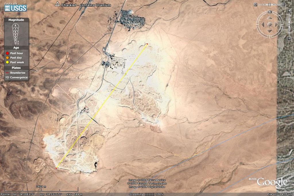
The third part of the phosphate WMD complex is the uranium that is chemically stored as part of the structure of the phosphate, itself. While this is only measured in parts per million (milligram per kilogram), Syria has a production capability at just one ore mining area of 2.65 Mt per year. Other, lesser deposits, are being mined: for example the 0.5 Mt per year in the Charkiet deposit. The production of enriched phosphate ore via processing yields 'yellowcake', which Saddam was looking for in Niger in 1998-99, as it is the first step towards getting more highly enriched uranium via further processing.
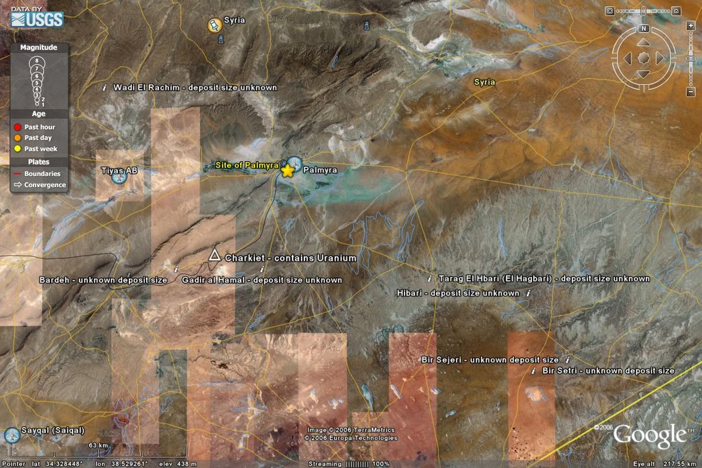
This plant has a rail siding running to the main processing house and is thusly connected directly into the railroad system of Syria. Additionally, tractor-trailer rigs are evident in the imagery, including tanker trucks, so this site appears to have large-scale need of transport for bulk, processed phosphate ore.
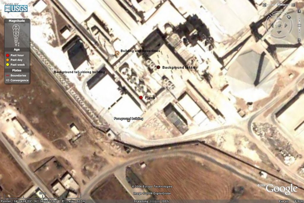
Thus with finishing plants elsewhere Syria can concentrate the uranium and segregate the 'yellowcake' as part of the production cycle and continue on with phosphate processing to other ends, all in the comfort and safety of factories dedicated to civilian phosphate production. The most worrying part of this is the facility purchased from Sweden constructed by MEAB for such work that is definitely in the 'triple use' category for not only civilian products, but uranium separation and phosphate production for chem/bio weapons. Now that company has provided exactly ONE photograph of the plant, which is heavily tinted and such, but the layout of it is clear.
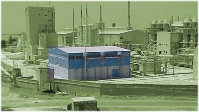 MEAB SAEC plant Homs, Syria
This plant has been variously cited by Congress, International Arms Control Agencies and assorted press accounts as being: co-located with the Homs oil refinery, adjacent to the refinery, underground, or 'nearby' the refinery. The problem with the oil refinery, itself, is that it lacks one resource that would greatly help processing phosphatic chemistry: water. It is very possible to pipe water in, but for the huge amount that Syria aims to process a more ready supply would seem necessary. Thus the 'nearby' is about 7 km south of the refinery on the shores of Katina Lake, something that no source has bothered to tell us about.
 MEAB plant on Lake Katina by the town of same name
Note the rail line curving off to the NorthEast of Katina and into the plant itself and the sidings inside the plant to receive rail shipments.
Here is the angle view of the plant, to get some perspective and direction similar to that of the photograph:

And then the top down view for planar review:
This is the plant that the Swedes feel 'snookered' about as they thought it was going to be going for the separation of uranium for purification of the phosphate, not to separate it for 'yellowcake' production. Such are the vicissitudes of chemistry and WMD production. I go over most of this in my post on Homs and Palmyra. That covers the basics of where the foundation of the Syrian WMD program is, and how it works. Out of this, beyond the huge tonnage of phosphate that is left over, the amount of U-235 that becomes available in 'yellowcake' form is that for about 5-6 nuclear devices of the AQ Khan design in Pakistan. That is mentioned as Iran had deep ties in that web by being a purchasing agent and shipper for such things as the Mitutoyo nuclear separators.
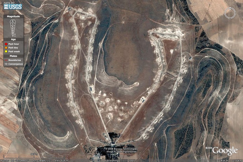
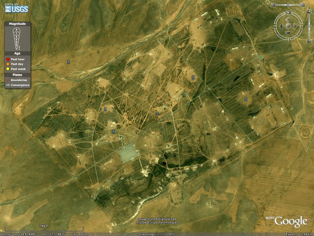
From here is a jog into the chemical and, most likely, biological weapons component that Syria has going and they have married that up with their SCUD missile production area to the SouthEast of Aleppo at Al Safira, which is at the bottom right of this imagery snap.

For anyone serious about getting good INTEL on this site, the place to head to is GlobalSecurity.org as they have a raft of imagery and analysis on it. So a look at that is now in order and first up is the large overview of the CW and Missile combined facility.
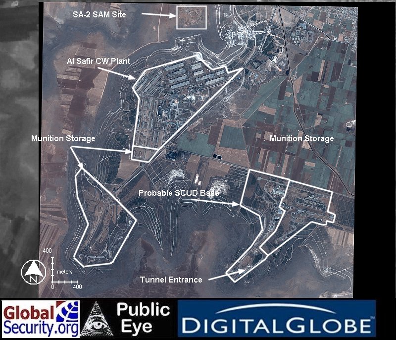 Source: GlobalSecurity.org
The layout of this place is pretty easy and spotting it in Google Earth is similarly so as it is on a 'U' shaped ridge or hilltop.
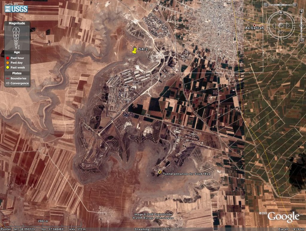
Because it is so distinctive it is easy to find. One of the great features of Google Earth is the ability to put in an overlay and fit it, within reason, to the actual imagery. I covered how to do that with this post on the Tell Hamoukar archaeological site, and the lessons learned for that are equally applicable to imagery on imagery. And that overlay looks like this
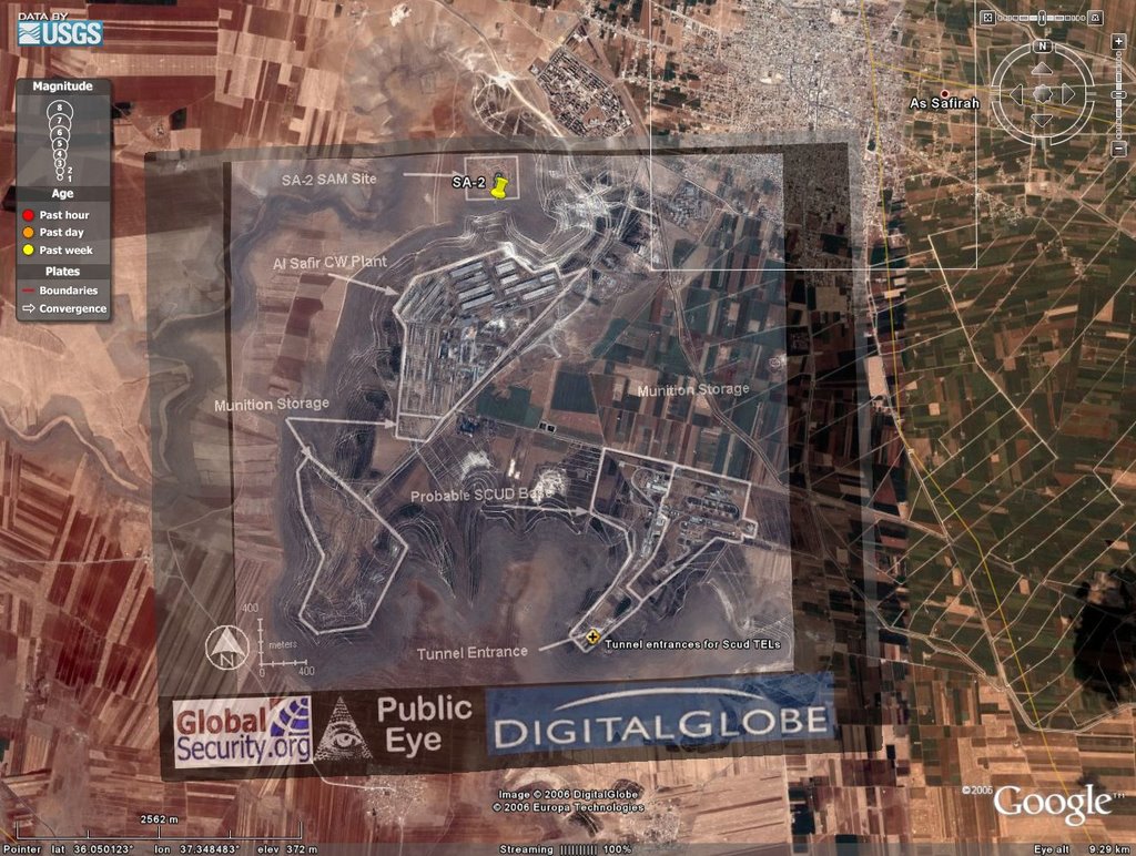
The lovely benefit of having someone else having done the work for you! Now, one may peruse the GlobalSecurity folks for the full run-down on this site, and the test firing range and capabilities and chemical complex and all the lovely odds and ends there. The Syrians have done a wonderful job of making this a fully integrated and operational area for the production of SCUDs and chemical weapon's warheads. A sort of 'one-stop shop' of mass destruction at a distance.
What comes next is a bit of imagery analysis with Google Earth, so be patient, it is important.
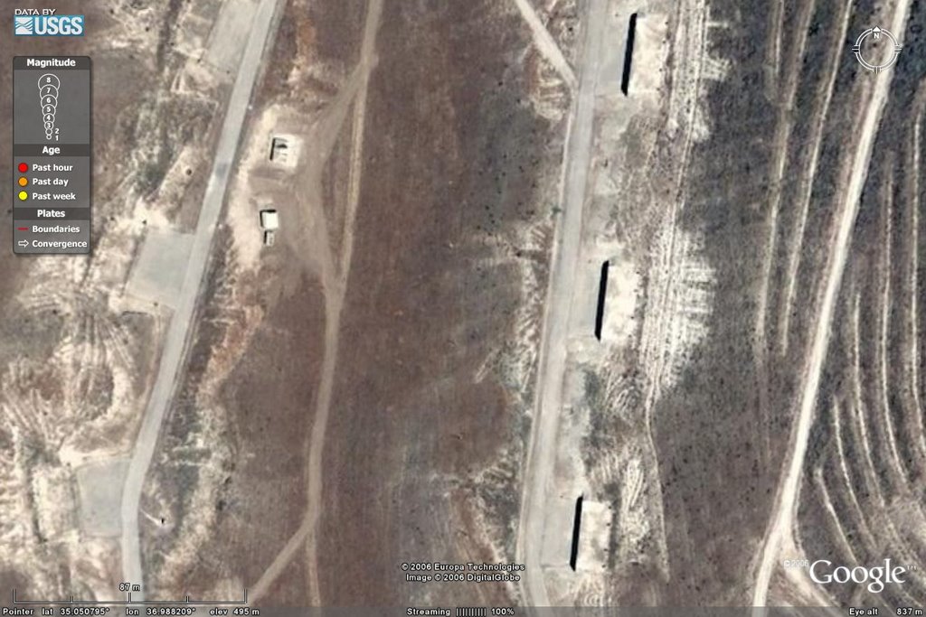
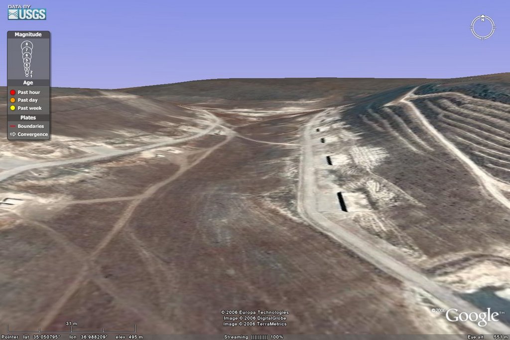
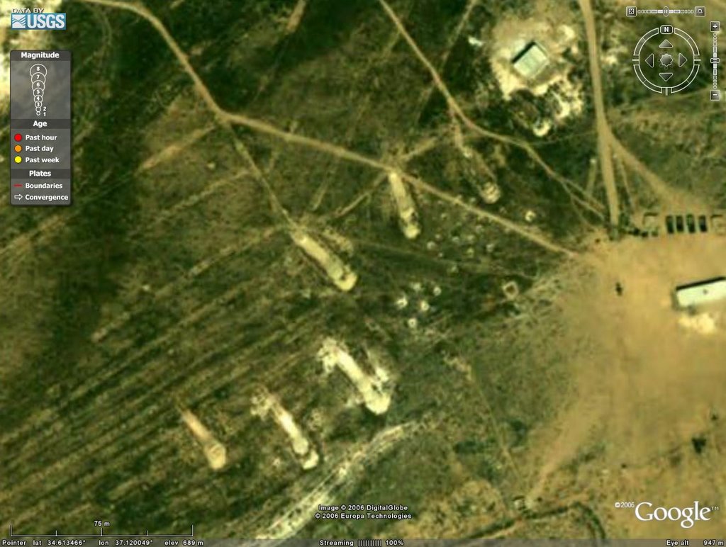
One of the foundational problems of finding buried sites is that they are, well, buried. However, when moving large objects, say missiles, in and out of an underground facility one must have these things known as 'surface entrances'. Now Batman went through a good deal of trouble to hide the entrance to the Batcave and, being a wealthy individual, could afford to do so. Syria, lacking temperate vegetation and easy money has to make do with something a bit less than that, plus it needs to move SCUDs with their TEL carriers into and out of their bunkers. Global security has this image, which I will overlay and then zoom in:
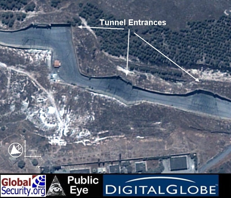
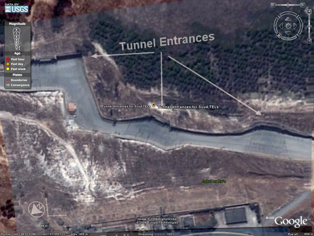
Notice how, when tilted, the tunnel entrance is definitely conforming to the flat surfaces? That is indicative of a sheer face and these entrances conform to those sheer faces. That is the underlying elevation information of Google Earth with the imagery draped on it. Together features such as this become immediately obvious, when from the overhead view you see what appears to be a shadow with nothing to cast it. A bit further on the tilt and the presence is obvious.
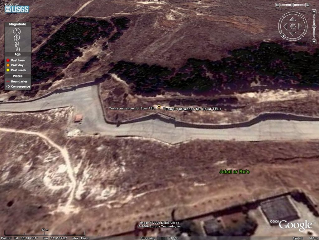
Clearly these are entrances into a hillside. That little bit of work will come in handy as the next bit is not so clearly seen until you get there.
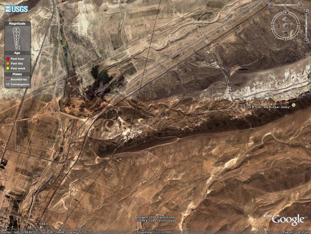
The senior journalist, Nizar Nayouf, apparently got a bit too close to a few things while he was in Syria and decided to defect from Syria so as to retain his life. The basic story is here, but the important thing is that beyond the Katina site near Homs and the al-Safira site near Aleppo, he lists three other places where WMD research, production and storage are going on. I covered my search for those sites in this post on finding the mentioned, but not pointed out. One site has very poor imagery in Google Earth and, thus, no real analysis can be done there. A second site sits in the middle of a weapons testing complex that sprawls all over the place, so that is relatively easy to spot. However, the third place near Tal Snan is mentioned as an underground facility.
Yes, in that coloful blobfield is a military base AND an underground weapon's complex! The base was easy to find and the complex took a bit of figuring out. But, with the help of the terrain draping effect it becomes readily apparent.
So first glance:
Closer in:
Then tilt:
There is definitely an underground complex here with doors big enough to take in SCUDs. And since nothing comparable gets built like this in Syria, it can only be the place the journalist cited. Without better INTEL, but having this as part of an overall confirmation of structure type and placement, the burden of doubt shifts from the reporter to those trying to nay-say the place. It exists, it has entrances into a hillside, is placed where it was claimed to be and does, indeed, look like something very similar to al-Safira in layout, but on a larger scale.
From here it is to the Furqlus Depot, as cited at NTI.org. That was described as a chemical munitions storage area by the Defense Intelligence Agency and being some 40 km SE of Homs. So back to Homs and I will add in a nice marker using the measurement tool and then zoom into the depot itself.
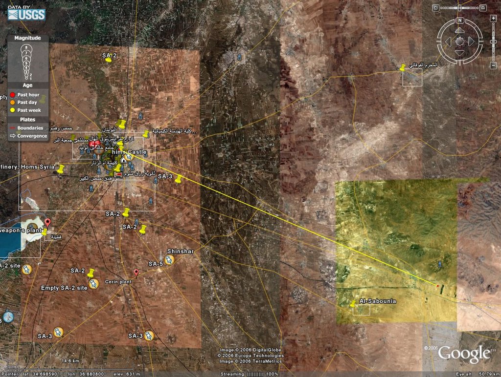
Of note is the different dates on imagery and the tonal contrasts between them. So long as there is continuity between features, however, that should not deter one from getting a good, hard look at places. Now for the close-up.
There it is in all of its glory! Another user has put in some markers for SAM sites in the base. The controlled access point on the SouthWest and general layout of this place is indicative of a major base, as was seen on my post on the not pointed out and *that* base. Similarly, this one has that control point to it. But one thing is extremely telling and I will zoom up for a good, close look on it.
Each of those oblong objects is a tractor trailer rig, with the trailer being some 25m long. These are the Transport Erector Launchers for SCUDs. The central building is obviously some central storage facility for these devices, either whole or in-part.
Now for the fun, or lack thereof, of finding the Khan Abu Shamat depot. It is supposed to be 20km due East of Dumayr and heading over there I will place down another measurement line.
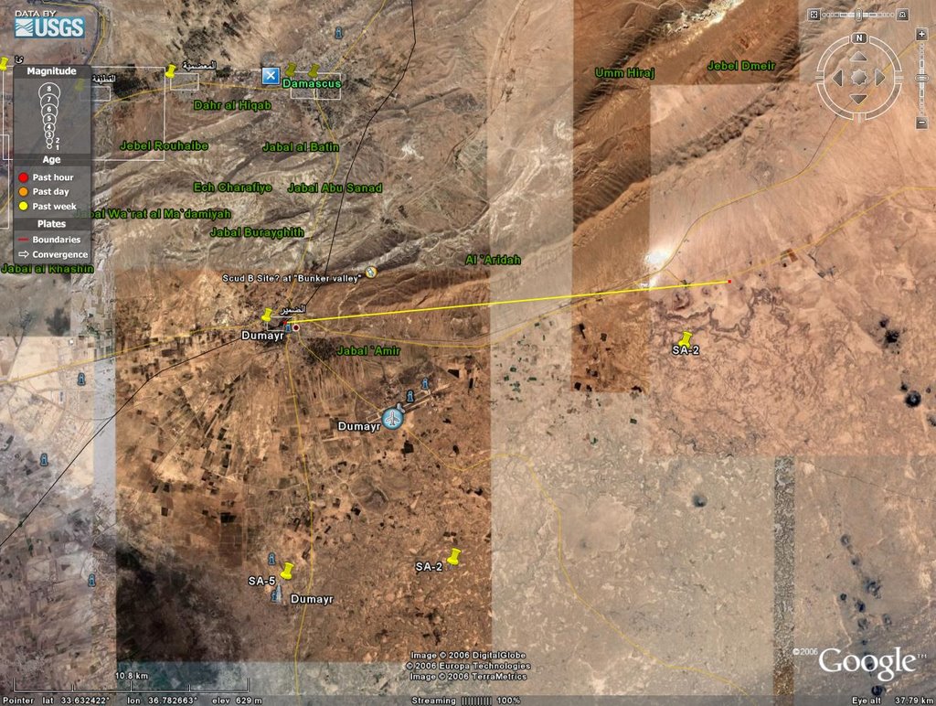
Again, not a site wonderful to behold. That said the Google Earth community members had a person or two a bit interested in this and they have already taken a look here and dropped off the SCUD Alley marker.
Unseen nearby is one of the phosphate markers that I dropped way back when for scoping that out and it is, indeed, for the Dumeir Deposit, which extends about 50 km to the NNE along this set of ridges. But the controlled entrance, again marking this as a primarily military site, but dual use. The 'dual use' is that it is also for phosphate mining, thus allowing for mining into the hillside, then stabilizing that cut and using it for military storage. Here, again, a tilt will clearly show the storage areas for SCUDs.

The actual settlement, can't really call it a town, of Khan Abu Shamat lies on the other side of the ridgeline to the south. There are large and small phosphate mining areas all through this area, but this central one is definitely not only for mining, but for military storage as one does not put permanent hillside entrances into a hill when the majority of mining is open surface. With all of that said, the mining here appears to be a distant thing of the past and the more active areas on the other side of the ridgeline. So perhaps only 'dual use' for general locale, only.
There are still many more sites on the long list of places to find, some, like al-Bayda, will wait until better imagery or more ground photos can be found. Stuff like oil refineries, which are obvious and easy to spot, I am not including, save to give a quick 'once over' to ensure that nothing strange is going on there. Smaller facilities for research in cities are a difficult thing to find without an actual address or geo-coordinates or, rarest of all, a photo of it can be found. Thus they are also put on hold until such can be found. And the eastern part of Syria, save for one city and a few border strips, are still pretty much 'blobography' that requires good and solid backup information to identify things beyond towns and fields and such.
So I hope you have enjoyed your tour.
Oh, and one other thing: any or all of the storage sites could have easily hidden a few truckloads of stuff from Saddam's WMD industry. Syria may have actually displaced some of its own material to the Sudan to do this. And the sprawling nature of the Khan Abu Shamat site would easily and quickly lend itself to hiding such materials by the truckload. If it can take a TEL with SCUD, then a flatbed trailer is no problem at all.


 Supporting Friends and Allies


No comments:
Post a Comment