For me the past few days have been tiring, as I have been refreshing my observation skills and learning how to find things that just don't want to be found. And some of that deals with Syria and its fun with WMDs. One of the fun tidbits I learned is that Syria has NOT signed the chemical weapons convention treaty, so they are free to deploy all sorts of lovely toxins at their beck and call. What is it with these Ba'athists and chemical weapons, anyways?
Be that as it may, I found a Lebanese site trying to expose the Syrian regime's long-term goals of WMDs. And they have this little lovely page on someone who got a Syrian journalist's notes on three facilities out so that the world could learn a bit more of what Syria was doing and where. The english translation with hand drawn map goes like this:
Nizar Nayuf (Nayyouf-Nayyuf), a Syrian journalist who recently defected from Syria to Western Europe and is known for bravely challenging the Syrian regime, said in a letter Monday, January 5, to Dutch newspaper “De Telegraaf,” that he knows the three sites where Iraq's Weapons of Mass Destruction (WMD) are kept. The storage places are:Well it sounded a bit problematical, to be sure, but this is the era of DIY INTEL Analysis via IMINT and multiple sources, so I decided to take a look. A quick check on GlobalSecurity.com and a few of the linked documents so that I understood the kind of place that I was looking for and then I got Google Earth up and running, made sure to turn on the Community Layers and found the last site south of Homs immediately. That said it was described in a few documents and someone else had found it first.-1- Tunnels dug under the town of al-Baida near the city of Hama in northern Syria. These tunnels are an integral part of an underground factory, built by the North Koreans, for producing Syrian Scud missiles. Iraqi chemical weapons and long-range missiles are stored in these tunnels.
-2- The village of Tal Snan, north of the town of Salamija, where there is a big Syrian air force camp. Vital parts of Iraq's WMD are stored there.
-3-. The city of Sjinsjar on the Syrian border with the Lebanon, south of Homs city.
Nayouf writes that the transfer of Iraqi WMD to Syria was organized by the commanders of Saddam Hussein's Special Republican Guard, including General Shalish, with the help of Assif Shoakat , Bashar Assad's cousin. Shoakat is the CEO of Bhaha, an import/export company owned by the Assad family.
In February 2003, a month before America's invasion in Iraq, very few are aware about the efforts to bring the Weapons of Mass Destruction from Iraq to Syria, and the personal involvement of Bashar Assad and his family in the operation. Nayouf, who has won prizes for journalistic integrity, says he wrote his letter because he has terminal cancer.
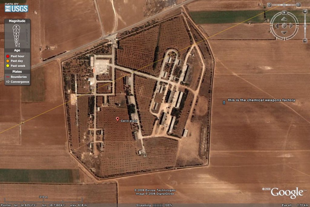
Now, heading to the first site I found the imagery to be far less than satisfactory, and I knew it would be a tough job, so I put that off. When you are working with color blobs instead of nice, nead well defined shapes, you are really at a huge loss when doing imagery analysis. Thus I wandered off to the area between Hama and Salamiyah, which looked like this when I got there:
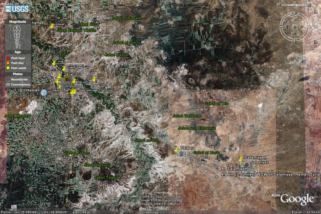


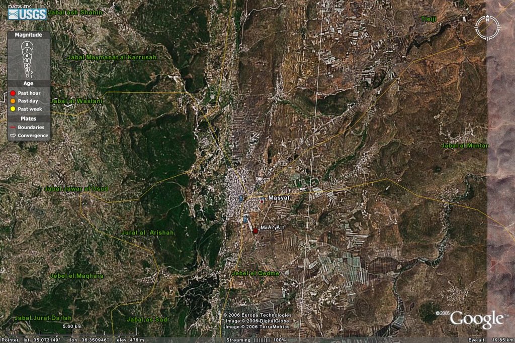
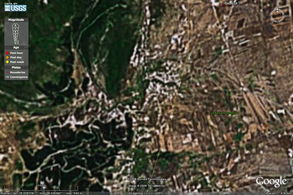
From there I looked south and came to this lovely area:
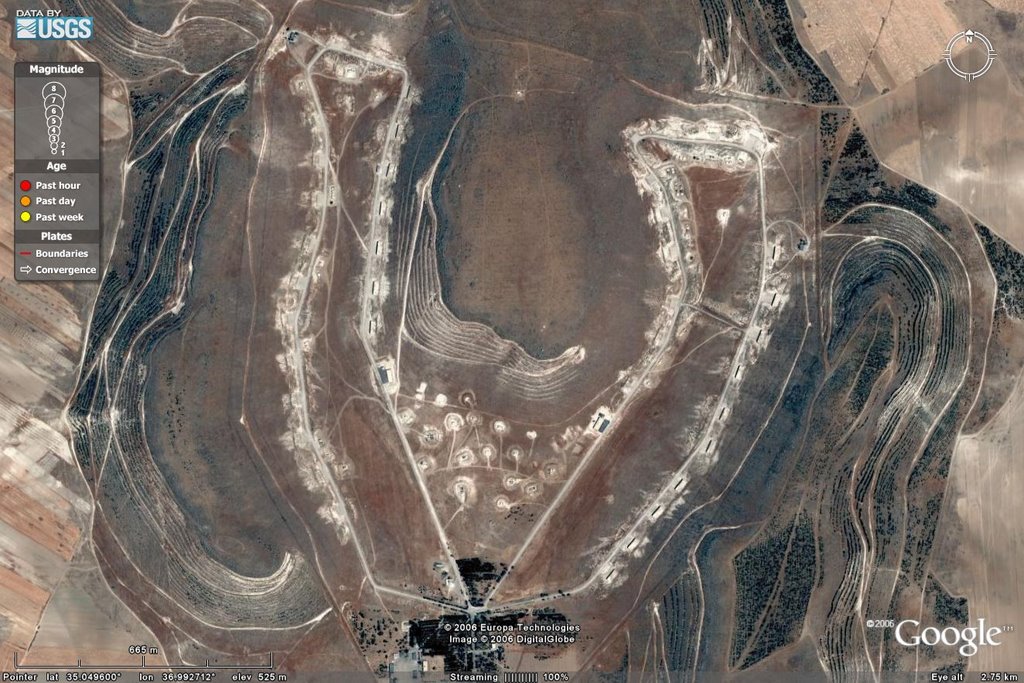
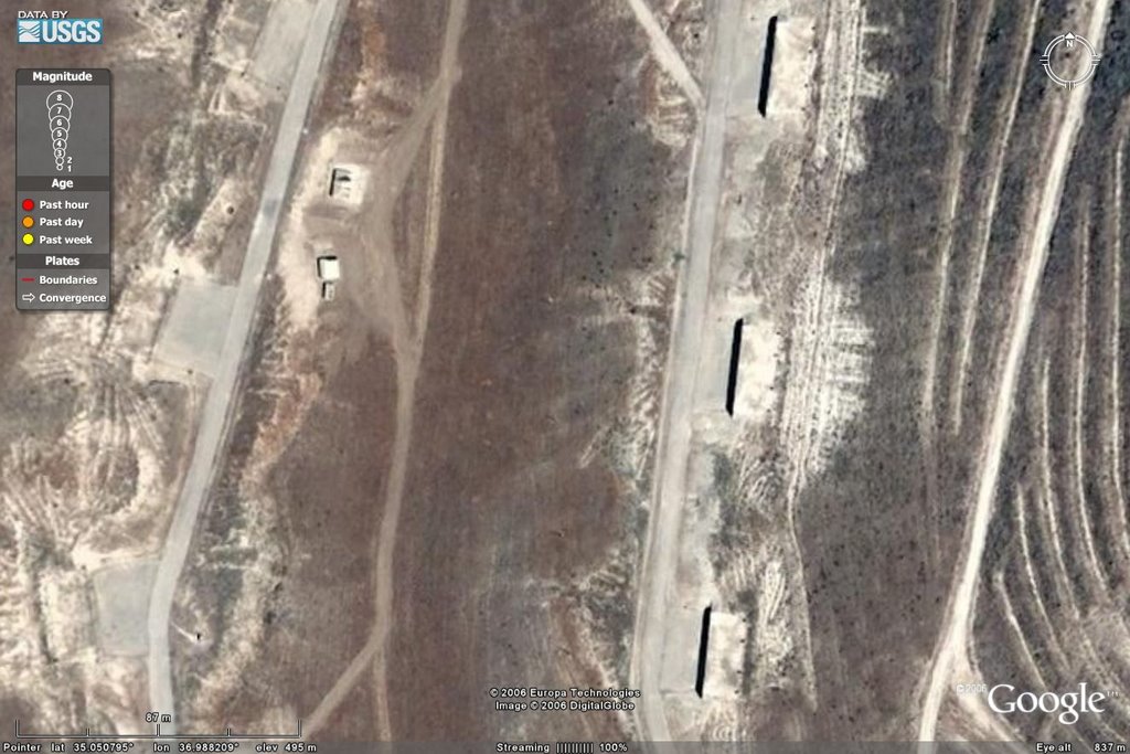
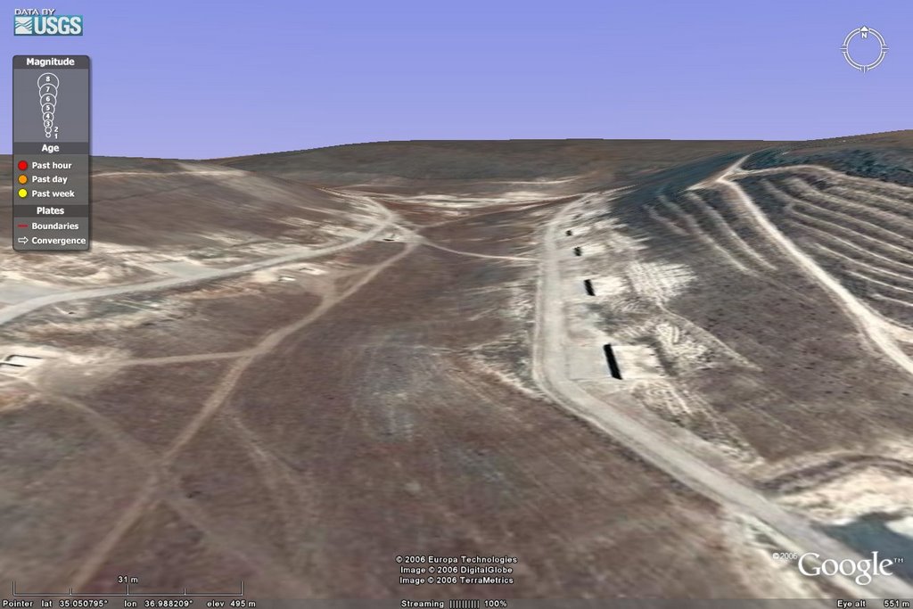
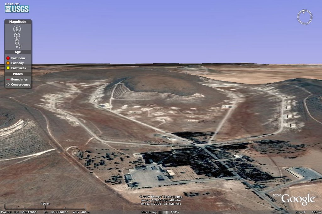
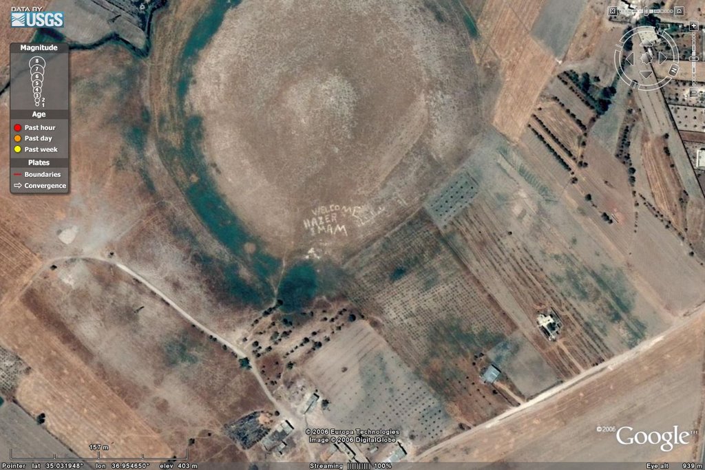
Finding Masayaf I had done before, and let me give you the image. And, no, it does not resolve better than this... getting closer just shows the pixelation. The underlying image is junk.
I know.
I checked them out.
Always check up on these leads, and in the Middle East phonetic spellings get you multiple similar names. I have been trying to pin down dar al-Hajar which is also: dar al-Hadjar, Al Hajjar, El Hajer, dayr el-Hajar, and dar al-Jajar. I have found that place, but it doesn't look like a nuclear research lab to me. None of them.
So, back to the looking for al-Baida!
Now, search engines are your friends if you just keep hitting them with different approaches and clicking through a few levels of junk. Finally, on page 4 or 5 of my 9th go-around I ran across this page which claimed to be the town page for Al Bayda. I had to look *that* name up and I think it was satelliteviews that finally got me actual image and coordinates for it. And it fit, more or less, with where it was described to be.
 It's in there, somewhere.
So that was a good, first tentative step... but the imagery sucks. Clearly, it is awful and I was overjoyed to get TWO shots of the perspective shots of the town from a nearby hill at the town's webpage!
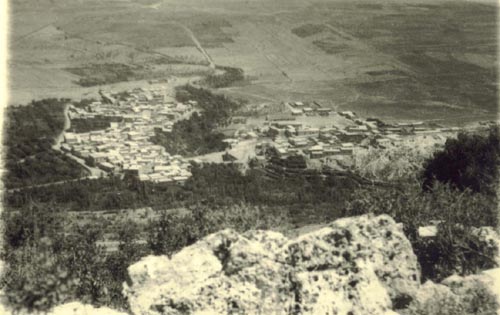 al-Bayda, 1975
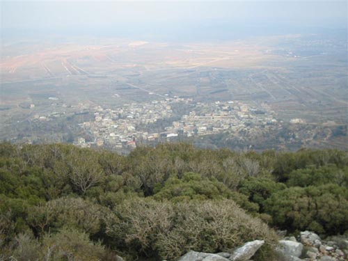 al-Bayda, 2005
Ok, they don't do much good, do they? No real landmarks to tie to in the very coarse imagery and the roads are so non-defined that the photos bear no similarity to what is in Google Earth. These high quality images do NOT have enough tie points for me to definitively say, for my purposes, that I had found the town of al-Baida. And so I searched.
And searched.
And searched.
And then I started using Masayaf to see if I could get *anything* nearby. And with the right mixture of keywords I was able to find someone at Flickr that had a PANORAMIC shot of Masayaf! Thank you, DWinton! I pulled down the hi-resolution of THAT and it was beautiful! I will post it here, but blogspot will reduce it... hit the link to get the original. It is a work of art!
 Masayaf from Sheikh Ghadban
I call this 0.80 certainty for the town, itself. The first hand account has proven to be highly accurate at least to 0.75 to 0.80, too, up to this point. So the *possibility* for a secret CW site here is in the 0.60 range or so. The imagery, however, is junk and will not yield up that information for certainty to be put in play. It is highly possible and maybe even *probable* but there needs to be a third confirming source, like a photo taken from the valley looking *up* to the mountains with a glimpse of a dark overhang tunnel entrance. No luck on that.
So there ends my quest of the last few days. Sharpening my imagry analyst skills to start taking on the Eastern Part of Syria. And the hunt for the nuclear group and their brand-new facility that has gone up the past few years. I am sure other weird things will be seen.


 Supporting Friends and Allies


No comments:
Post a Comment